
Illinois Airports
|
 Chicago O'hare International Airport and
Chicago Midway Airport
serve Chicagoland, and are illinois's leading airports.
Other major Illinois airports include the Abraham Lincoln Capital Airport in Springfield,
the Central Illinois Regional Airport in Bloomington,
the Champaign Willard Airport,
the Decatur Airport,
the Greater Rockford Airport,
the Peoria Regional Airport,
the Quad City International Airport in Moline, and
the Veterans Airport in Marion.
Chicago O'hare International Airport and
Chicago Midway Airport
serve Chicagoland, and are illinois's leading airports.
Other major Illinois airports include the Abraham Lincoln Capital Airport in Springfield,
the Central Illinois Regional Airport in Bloomington,
the Champaign Willard Airport,
the Decatur Airport,
the Greater Rockford Airport,
the Peoria Regional Airport,
the Quad City International Airport in Moline, and
the Veterans Airport in Marion.
The photo at right shows a jet aircraft arriving at O'hare International Airport.
Interactive Illinois Airports Map
This section features an airport locator map that can be zoomed and panned to show the state of Illinois and its neighbors or a small region of the state. Use the plus (+) and minus (-) buttons to zoom the map in and out, respectively. Simply swipe or drag the map to pan it in any direction. The airport markers on this Illinois map can help travelers find IATA-designated airports in the state and plan their air travel arrangements more efficiently.
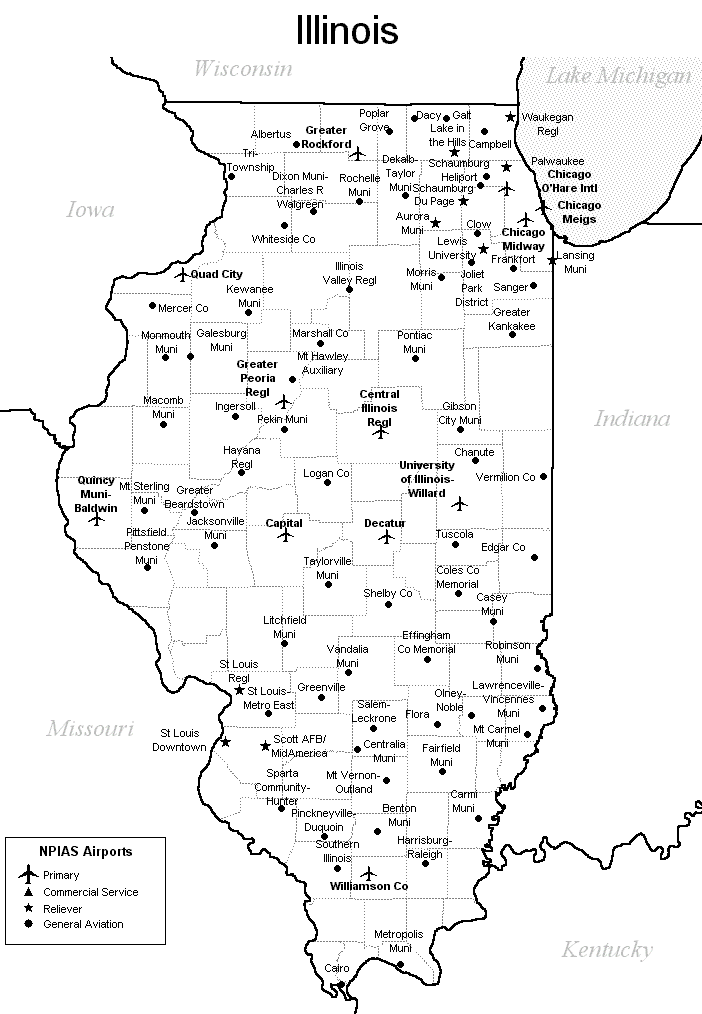
FAA Illinois Airport Locator Map
This Illinois airport map shows FAA-designated commercial service airports, reliever airports, and general aviation airports in the State of Illinois. Primary airports are designated with an airplane symbol.
Copyright © State-Maps.org. All rights reserved.
Illinois airport map source: FAA 2001-2005 NPIAS.
Illinois airport map source: FAA 2001-2005 NPIAS.